Help - Preferences |
|
|
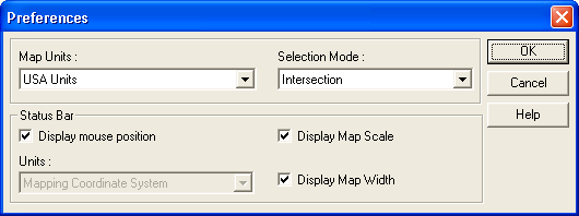
You can use the Preferences dialog box to customize the selection mode and the mapping window's status bar.
Note: Click on any of the Popup Menu items below to view specific help for that topic.
To modify user preferences right-click in the mapping window and then choose Help > Preferences... from the popup menu.
You will then see the Preferences dialog box.
Map Units: Use the Map Units drop-down list box to choose the type of units used to display distances and map widths. Choose USA Units to display distances and map widths in feet/miles, or choose Metric to display distances and map widths in meters/kilometers. The map unit type is displayed in the mapping window status bar.
By default, when selecting features inside a rectangle, circle, polygon, or buffer, gMap (MapGuide) selects only those features whose centroids (center points) are within that selection area. However, you can specify that you also want to select features that intersect the selection area.
To specify the selection mode click the Selection Mode drop-down list, and then choose the method you want to use for selecting features inside of other features.
If you choose Centroid (the default), only those features whose centroids are within the selection area will be selected. If you choose Intersection, features that touch, intersect, or are within the selection area will be selected.
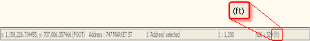
Mouse Position: To display the coordinates of the mouse pointer position on the mapping window's status bar as you move the mouse around on the map, select the Display Mouse Position check box.
Units: This application does not utilize this option since it uses Arbitrary XY coordinates which is why it is disabled in the Preferences dialogue box above.
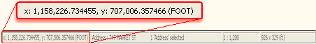
Map Scale: To display the map scale on the status bar, select the Display Map Scale check box.
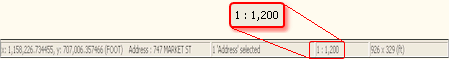
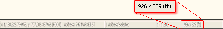
Map Width: To display the map width on the status bar, select the Display Map Width check box.
Tip: If there is not enough room on the mapping window's status bar to display all three of the check box's information, then clear the Mouse Position, Map Scale and/or the Map Width check boxes to make more room.
|